Huntley Quarry and May Hill
On April 7th 2010 members of the Malvern U3A geology group met to walk around Huntley Quarry, Brights Hill Quarry and to climb May Hill. A circular walk of 5.5 miles, that included a good lunch at the Yew Tree Inn en route. Two of our members, Elizabeth Staley and Mary Geffen, wrote this report. Click here for:
· More information on Huntley Quarry and May Hill
More information on Huntley Quarry and May Hill
For £2, a small booklet is available at the Gloucestershire Geology Trust (info@glosgeotrust.org.uk) ,The Tithe Barn Centre , Brockworth. GL3 4QU. Click here.
Because this area is so complex and interesting, we cannot hope in this report to give more than the basics of what we saw and learned in a couple of hours. We therefore recommend the Trust’s Guide.
A guide to May Hill has also been produced by the Trust.
In addition, see pages 116 to 119 of the Geopark Way book, produced by the local Earth Heritage Trust. You can purchase it from Herefordshire and Worcestershire Earth Heritage Trust; Geological Records Centre; University of Worcester; Henwick Grove; Worcester WR2 6AJ (01905 855184).
The route
The walk started at Huntley Quarry, map reference SO 7095 1955. This is situated about 1km to the West of Huntley village, on the Gloucester to Ross Road (A40). Brights Hill Quarry is around 400 metres to the East of Huntley Quarry, follow the A40 road East to Huntley.
We then followed the Geopark Way, joining the Gloucestershire Way, to the summit of May Hill. The descent followed a Northerly route with a lunch stop at the Yew Tree Inn, Clifford’s Mesne (map reference 699 227).
We retuned via another route, skirting the Eastern side of May Hill. We stopped to look at outcrops (map reference 700 214).
Visit report
The Quarries
Their complexity has puzzled geologists for a long time. In the words of our guide:
”What I am standing on is the Blaisdon Fault which is the Southern part of the Malvern Fault Complex. The rocks span a complex age range; thermoplastic stuff; Mercian mudstone; and Palaeozoic stuff. On geology maps, until recently, the tiny brown speck of Huntley Quarry Beds was labelled “age uncertain”. Only recently, industrial research (carried out in 1985) has been re-examined and shows micro-fossil evidence that dates these Huntley Quarry Beds as earliest Silurian/late Ordovician.”
The Huntley Quarry and the Brights Hill Quarry
To our left as we stood before the quarry looking at the Southerly part of the face we saw “very nicely flat-bedded, quartzy gritty sandstone layers, almost horizontal and interspersed with layers of very loose shaley stuff, broken up”. These, our guide said, are fluvial, the result of river bed action. Along the very base of each of the shale layers, we saw thin streaks of yellowed staining. This is the result of volcanic ash which has settled on the fractured top layers and then seeped down and weathered.
There is also volcanic material, glass and ash, integrated within the sandstones of the Huntley Quarry Beds themselves; these rocks are “volcaniclastic” . Where were the volcanoes? Possibly in the beds of early Silurian volcanoes outcropping in the Cotswolds.
Among these horizontal layers, we could see graded bedding, i.e. the coarser grains had been deposited below the finer grains, probably in water. We were told that higher up the rock face, the grading was quite upside-down (i,e, the larger grains at the top). This was evidence of overturned – or upside down – folded sandstone layers.
Looking further to our right, towards the North side of the quarry, the beds started curving upward, eventually 48 º from the horizontal. There is a marked contrast between the relatively orderly and regular layers to the left and crumpled, curving layers to the right.
In the words of our guide,
“Along this plane the beds start curving up;. A continental collision occurred. My chairman called it a continental car crash between England and Wales; this is the crumple zone on the bonnet. The rocks have collided and have folded up and over, right over.
We know the right way up at this point; we can see graded bedding in banded sandstone. We have overturned bedding up there (where the vegetation covers the top of the face). So we have not merely the initial early tectonic structures going on; something else is going on at this point; it has chewed them up and churned them up. We have two things; two tectonic plates going on, the Caledonian and the Hercynian”; (aka. the Variscan).
In short , we were looking at a long history of movement.
“Faults in every direction; all sorts of things coming together at different times. The initial Caledonian stuff crashing together and then the Variscan.”
The Blaisdon Fault and the Severn Vale
We were able to stand on the Blaisdon fault – a bit boggy, because water seeps along the fault edge under pressure from the sandstones underneath.
It was especially interesting at Huntley to see the continuation of familiar Malvern features from our home ground twenty miles away. The rock structures in Huntley quarry are a continuation of the North/South Fault that some of us had seen months ago, well exposed above Tank Quarry car park in North Malvern. At Tank quarry ,the very old pre-Cambrian rocks are dramatically faulted above a 3km thick layer of more recent, softer Triassic rocks and clays across the Severn Valley. Here in Huntley, we found an element of the same fault, (i.e. the Blaisdon Fault) but with a difference. The visible fault edge at Huntley was not Pre-Cambrian rock (as at Tank Quarry), but the 45º tilted edge of Silurian/Ordovician rock. The Pre-Cambrian rock layer was still there at Huntley as in Malvern, but invisible underneath us.
The most intriguing (and difficult to imagine) rock of the day was produced by our guide in Brights Hill Quarry as evidence of the huge and conflicting structural movements in this area. This was a very roughly cube-shaped and flat-sided chunk of sandstone. He pointed out slickensides on all of its sides. Slickensides are parallel streaks of scratchy grooves resulting from intense pressure and slippage during earth movements. The rock is “re-mineralised” or converted into smooth, slightly glassy streaks along the direction of the tensions. To quote again
“If you are familiar with the idea that when rocks are forced past each other they show slickensides, you can get the idea of how much this rock has been messed up – striations on every facet. It really has been mangled and chewed up on every facet.”
May Hill
From the quarry, we skirted round Brights Hill, crossed a small valley and started up May Hill, following the Gloucestershire Way. There were geological clues in, for example, an old brick kiln chimney suggesting a local clay bed, and a new stone wall built of local sandstone with occasional Silurian and carboniferous limestones. Fields and houses gave way to woods, until we came out onto the gently rounded grassy area leading up to the clump of pines at the top - a familiar land mark visible from most of our South Midlands/Welsh borders region. The hill itself is an anticline, upraised on the north eastern side along the Glasshouse fault. The Huntley Hill beds form the upper part of the hill, almost encircled by the Yartleton beds (both part of the May Hill sandstone group). A dog-walking lady described May Hill to us appropriately as "the final blob of the Malverns"!
The summit is a wonderful view point, although at the time of our visit the weather was cloudy and hazy. We could see the magnificent meanders of the lower Severn, and the parallel ridges to the west towards the Forest of Dean, consisting of successive Silurian and Devonian beds. The more distant hills to the North West, and the Woolhope Dome and Malvern Hills were barely visible. A track took us down the north side of the hill to our lunch at Clifford's Mesne.
In the afternoon we headed back around the east side of May Hill, roughly along the junction of the Huntley Hill Formation ( coarse red-grey sandstones) and overlying Yartleton beds ( finer, pale yellow sandstones and siltstones). We found fragments of brachiopod and gastropod fossils in pieces of siltstone lying by the track. At one point a fault (now overgrown) had displaced the beds so that the Huntley Hill outcrop was to the left but on the same level as the Yartleton rocks. Surface water and a small valley probably follow the fault.
We gradually dropped down to rejoin our outward route, and returned over Brights Hill (where some members got temporarily lost!) to Huntley Church.
Pictures of the walk
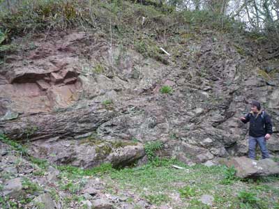
Our guide explaining the thrust faulting in Huntley Quarry.
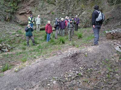
Our guide stands on the Basildon Fault. This fault is an extension of the East Malvern Fault Complex.
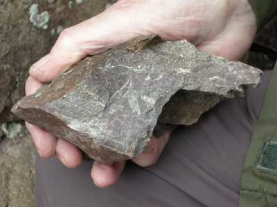
A rock from the Huntley Quarry Beds. There is only a very small exposure of these Silurian rocks. It is thought that they were deposited in a near-shore environment, on the edge of an eroding landmass.
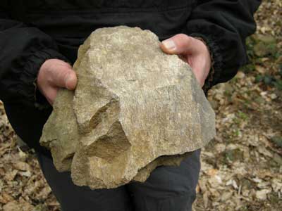
Sandstone from Brights Hill Quarry showing slickensides. The early Silurian sandstones were deposited in a shallow marine environment.
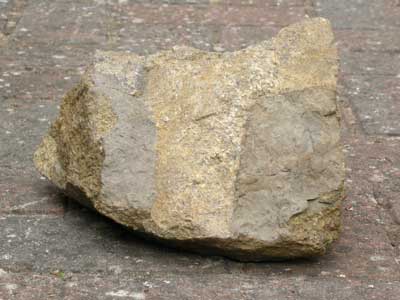
Brights Hill Quarry - mudstone clasts within the sandstone.
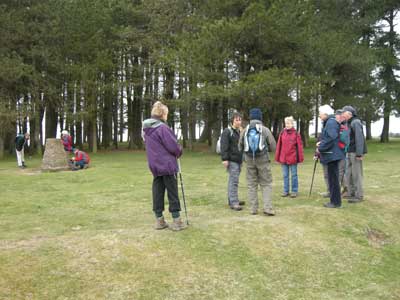
The group reach the summit of May Hill.
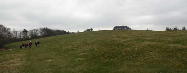
The walk continues. The pines on the summit of May Hill, visible here, can be seen for many miles.
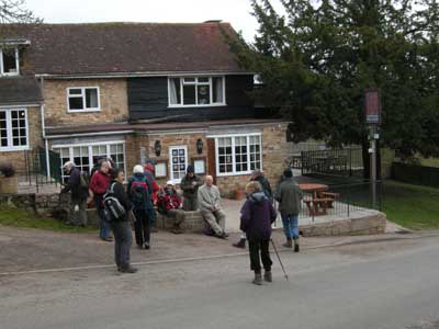
Lunch at the Yew Tree Inn, Clifford’s Mesne.
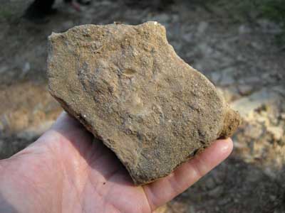
We found outcrops as we walked around the Eastern flanks of May Hill. This is Silurian Yartleton Formation, laid down in marine conditions.
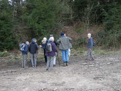
Examining outcrops of the coarse red-grey sandstone which forms the summit of May Hill, and the later Yartleton beds.